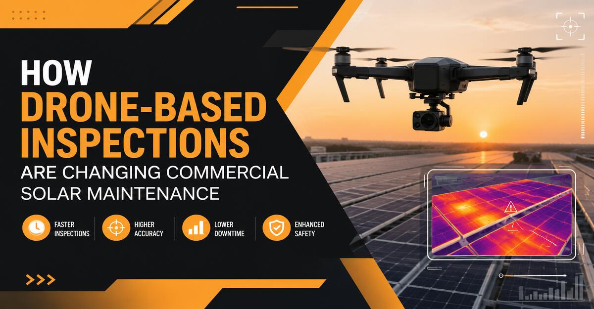
Drone-based inspections are changing commercial solar maintenance by replacing slow, sample-based visual checks with rapid, georeferenced thermal and optical surveys of entire photovoltaic arrays. They help asset managers locate underperforming modules, prioritize repairs, reduce roof exposure, document recurring defects, and convert inspection data into targeted maintenance work.
Key Facts at a Glance
- Thermal drones can evaluate thousands of commercial solar modules during one planned flight.
- Radiometric thermal cameras measure temperature data, while RGB cameras document visible conditions.
- Drone inspections identify anomalies, but electrical testing is still required to confirm many root causes.
- Reliable thermal inspections require sufficient irradiance, stable weather, operating equipment, and controlled flight geometry.
- Georeferenced reports allow technicians to locate individual affected modules without searching entire arrays.
- Repeat inspections create a condition history that supports preventive maintenance, warranty claims, and asset planning.
What Is a Drone-Based Commercial Solar Inspection?
A drone-based commercial solar inspection uses an unmanned aircraft equipped with thermal and visual cameras to collect condition data across a photovoltaic system. Each image is linked to flight information such as location, altitude, camera angle, and capture time.
The thermal camera reveals temperature differences across modules, strings, electrical equipment, and surrounding surfaces. The visual camera records conditions such as broken glass, dirt accumulation, vegetation, standing water, damaged roofing, bird activity, shading, and displaced components.
Inspection software combines the images into a mapped representation of the site. Analysts then associate suspected defects with specific arrays, rows, strings, modules, inverters, or roof zones.
A drone inspection is not the repair itself. It is a diagnostic screening and maintenance-planning method that tells the technical team where closer testing is needed.
How Drone-Based Inspections Are Changing Commercial Solar Maintenance
Drone inspections are shifting commercial solar maintenance from broad scheduled checking toward condition-based intervention. Instead of sending technicians to examine large areas without knowing where faults are located, asset managers can dispatch them with a prioritized list of specific anomalies.
This change affects five parts of solar operations:
- Inspection coverage: Teams can review nearly the entire visible array instead of checking a limited sample.
- Labor allocation: Qualified electricians spend more time testing and repairing flagged equipment.
- Safety planning: Roof walking, ladder use, and exposure near energized equipment can be reduced.
- Documentation: Each anomaly can be stored with coordinates, images, severity, and inspection history.
- Maintenance timing: High-risk or high-loss defects can be addressed before lower-priority cosmetic conditions.
The greatest value is not simply that drones fly faster. The value comes from converting a large solar installation into a searchable, repeatable, and measurable asset map.
How Does Thermal Drone Inspection Work?
Thermal drone inspection works by identifying abnormal temperature patterns created by electrical resistance, current interruption, shading, material defects, or equipment failure. A properly operating array under stable sunlight should display reasonably consistent thermal behavior among comparable modules.
A typical workflow follows six stages.
1. Confirm the Inspection Objective
The inspection scope determines the flight plan, sensor requirements, image resolution, and report format.
Common objectives include:
- Post-installation commissioning
- Annual preventive maintenance
- Performance-loss investigation
- Post-storm assessment
- End-of-warranty inspection
- Rooftop condition assessment
- Suspected string or inverter failure
- Verification after repair
A storm triage flight may prioritize speed and broad outage detection. An end-of-warranty inspection may require lower-altitude imaging, module-level identification, detailed thermal measurements, and stronger documentation.
2. Prepare the Site and Asset Map
The inspection provider should obtain current site drawings, array layouts, inverter identifiers, string maps, module numbering, roof access rules, and known performance issues.
Poor asset records create problems even when the images are excellent. A report that identifies “hot module near the northwest corner” is less useful than one that identifies “Building B, Array 3, Row 7, Module 14.”
The operator should also confirm that the inspected equipment is energized and producing power. Disconnected, curtailed, shaded, or offline arrays may not develop the thermal patterns needed for meaningful comparison.
3. Verify Environmental Conditions
Thermal inspection requires enough solar energy to create observable temperature differences. Many inspection programs use approximately 600 watts per square meter as a minimum irradiance threshold, while stronger and more stable sunlight often produces clearer results.
The operator should monitor:
- Solar irradiance
- Cloud movement
- Wind speed
- Ambient temperature
- Recent rainfall
- Panel surface moisture
- Rapid changes in sunlight
- Shading from buildings or equipment
Thin clouds can create moving thermal patterns that resemble electrical anomalies. Strong wind may cool modules unevenly and reduce temperature contrast. Recent rain can temporarily change module and roof temperatures.
Conditions should be recorded throughout the inspection, not only before takeoff.
4. Capture Thermal and Visual Images
The aircraft normally follows a programmed grid or lawnmower flight path. Flight altitude, speed, overlap, and camera angle depend on the sensor, panel dimensions, roof geometry, desired ground sample distance, and inspection level.
High image overlap helps mapping software align repeated patterns across large arrays. Commercial solar sites are visually repetitive, so inadequate overlap can cause missing sections, distortion, or stitching failures.
The thermal payload should be radiometric when temperature measurement is required. A non-radiometric camera may display relative thermal contrast but cannot provide dependable temperature data for each pixel.
The operator must also manage reflections. Solar glass can reflect the sky, the sun, nearby structures, and the drone itself. A cold-looking or hot-looking area may therefore be a reflection rather than a defect.
5. Process and Classify the Data
Processing software organizes thousands of images into thermal maps, visual orthomosaics, asset models, or digital twins. Automated systems may then classify patterns associated with known fault categories.
Potential classifications include:
- Module hot spot
- Substring anomaly
- Bypass diode activation
- String outage
- Multi-module outage
- Inverter-related outage
- Potential induced degradation pattern
- Shading
- Soiling
- Cracked or damaged glass
- Vegetation obstruction
- Tracker misalignment
- Connector or junction-box heating
Artificial intelligence accelerates review, but it should not be treated as an unquestionable diagnosis. The same thermal pattern may have several possible causes.
For example, a hot substring could indicate a bypass diode condition, partial shading, internal module damage, or an external obstruction. The RGB image, electrical configuration, operating history, and field testing determine the final diagnosis.
6. Create and Close Maintenance Actions
The final report should convert imagery into repairable tasks. Each finding should include its exact location, defect category, severity, evidence, recommended validation method, and suggested response.
A practical maintenance cycle is:
Detect → Review → Prioritize → Test → Repair → Reinspect → Close
This final verification step is frequently overlooked. A repair should not be considered complete merely because a technician visited the location. Electrical data, replacement records, photographs, or a follow-up thermal check should confirm that the anomaly has been resolved.
Which Technologies Are Used?
Commercial solar drone inspection depends on several connected technologies rather than a single aircraft or camera.
Radiometric Thermal Cameras
Radiometric infrared cameras record temperature information for individual pixels. This allows analysts to compare the suspected anomaly with adjacent cells, modules, strings, or roof areas.
Thermal readings are influenced by:
- Surface emissivity
- Viewing angle
- Reflected temperature
- Atmospheric conditions
- Distance from the target
- Sensor calibration
- Wind cooling
- Irradiance changes
The temperature value displayed by software is not automatically the actual internal temperature of a solar cell. It is a calculated surface-temperature estimate based on camera settings and environmental assumptions.
RGB Cameras
High-resolution visual cameras provide context for thermal findings. They help distinguish internal electrical problems from dirt, debris, shading, damaged glass, pooled water, loose components, or roof conditions.
Thermal and RGB imagery should be reviewed together. Thermal imagery alone can reveal an abnormal pattern without explaining its cause.
RTK and Positioning Systems
Real-time kinematic positioning can improve flight repeatability and mapping accuracy. Accurate coordinates are particularly valuable when a site contains thousands of visually identical modules.
Positioning accuracy does not eliminate the need for a reliable asset map. GPS coordinates, module identifiers, and site drawings should support one another.
Photogrammetry and Analytics Platforms
Photogrammetry software aligns overlapping images and produces mapped site representations. Solar analytics platforms add module detection, anomaly classification, severity scoring, reporting, and maintenance-system integration.
Enterprise platforms may connect findings with:
- Computerized maintenance management systems
- Asset performance management platforms
- Geographic information systems
- Warranty databases
- Enterprise resource planning systems
- Technician dispatch applications
The integration quality often determines whether drone data becomes operationally useful or remains an isolated inspection report.
What Solar Defects Can Drones Detect?
Drones can detect many visible and thermal symptoms, but they cannot independently confirm every root cause.
| Detected pattern | Possible cause | Recommended follow-up |
|---|---|---|
| Single-cell hot spot | Cell damage, microcrack, shading, contamination | Visual review and electrical testing |
| Hot module section | Bypass diode activation or substring fault | Module testing and junction-box inspection |
| Entire hot module | Internal failure, mismatch, connection problem | Voltage and current testing |
| Multiple affected modules | String interruption, fuse issue, wiring fault | String-level electrical testing |
| Cold or inactive row | Disconnected string, inverter issue, open circuit | Combiner and inverter diagnostics |
| Edge-related thermal pattern | Possible degradation or voltage-related stress | Engineering review and comparative testing |
| Localized junction-box heating | Resistance, loose connection, diode issue | De-energized inspection by a qualified technician |
| Repeating shaded areas | Building, equipment, vegetation, or debris | Shade and obstruction assessment |
| Uneven tracker rows | Tracker fault or alignment issue | Mechanical and control-system inspection |
| Visual roof anomaly | Membrane damage, drainage issue, loose material | Roofing assessment |
A drone report should distinguish between an observed anomaly and a confirmed defect. This wording prevents thermal interpretation from being mistaken for completed electrical diagnosis.
Which Inspection Levels Are Most Useful?
Inspection depth should match the business purpose. Flying as low as possible and collecting the maximum amount of data is not always the most efficient approach.
Level 1: Rapid Overview
A rapid overview identifies major outages, broad thermal differences, storm damage, or disconnected sections.
It is useful for:
- Post-storm triage
- Large portfolio screening
- Preliminary performance investigations
- Confirming whether a deeper inspection is justified
Level 2: Standard Module-Level Inspection
A standard inspection balances coverage, image detail, flight time, and processing cost. It aims to identify module, substring, string, tracker, and equipment-level anomalies.
It is useful for:
- Annual maintenance
- Commercial rooftop portfolios
- Contractual inspections
- Preventive maintenance planning
- General warranty documentation
Level 3: Detailed Diagnostic Survey
A detailed survey uses more controlled image resolution, lower-altitude capture, stronger asset mapping, and closer analyst review.
It is useful for:
- Commissioning
- End-of-warranty reviews
- Recurring unexplained losses
- Cell-level anomaly investigation
- Formal engineering or warranty evidence
IEC 62446-3 provides guidance for outdoor infrared thermography of photovoltaic modules and plants. However, compliance depends on the complete inspection method, environmental documentation, equipment, competency, analysis, and reporting. Owning a thermal drone does not by itself make an inspection standards-compliant.
How Do Drones Improve Maintenance Safety?
Drones reduce the amount of initial roof walking and array searching required during inspections. This can lower exposure to falls, fragile roof surfaces, heat stress, electrical hazards, and difficult access areas.
The safety benefit is especially important on:
- Large warehouses
- Distribution centers
- Manufacturing buildings
- Schools and municipal facilities
- Shopping centers
- Agricultural buildings
- Carports and canopies
- Sites with fragile or steep roofing
Drones do not eliminate field risk. Technicians still need safe access to confirm, isolate, test, and repair equipment. The operational improvement is that they can approach the roof with known locations and planned tasks instead of searching blindly.
Are Drone Inspections Faster Than Manual Inspections?
Drone inspections generally collect array-wide imagery faster than technicians can complete equivalent module-by-module visual and thermal screening. The actual speed depends on airspace, roof layout, array density, battery logistics, weather, inspection resolution, and site complexity.
A simple ground-mounted site can be surveyed faster than a complex commercial rooftop with:
- Multiple roof levels
- Mechanical equipment
- Parapet walls
- Nearby airports
- Restricted takeoff zones
- Heavy pedestrian activity
- Several module orientations
- Strong reflections
- Shading from adjacent buildings
Claims that one drone can always inspect 50 to 100 MW per day should be treated as best-case utility-scale production figures, not universal commercial rooftop expectations. Processing, quality control, asset mapping, and reporting also require time after the flight.
Drone Inspection Versus Manual Inspection
Drone and manual inspections perform different functions. The strongest maintenance program combines broad aerial screening with targeted field diagnostics.
| Decision factor | Drone inspection | Manual inspection |
|---|---|---|
| Array coverage | Can capture most or all accessible modules | Often limited by time, access, and sampling |
| Roof exposure | Reduced during initial screening | Requires greater technician access |
| Location accuracy | Georeferenced maps and asset identifiers | Depends on notes, photos, and technician records |
| Thermal consistency | Repeatable flight plan under controlled conditions | Readings may vary with technician position and timing |
| Electrical confirmation | Limited | Supports meters, IV curves, insulation tests, and direct examination |
| Mechanical checks | Limited to visible evidence | Allows torque, attachment, wiring, and connector checks |
| Speed | High for broad screening | Slower for large arrays |
| Best use | Detection, mapping, prioritization, documentation | Confirmation, repair, testing, and closeout |
What Drones Cannot Replace
Drone inspections cannot replace:
- Insulation-resistance testing
- IV-curve tracing
- Ground-fault investigation
- Torque verification
- Connector examination
- Fuse testing
- Internal inverter diagnostics
- Roof leak investigation
- De-energized electrical inspection
- Qualified engineering judgment
A thermal anomaly identifies where to investigate. It does not automatically reveal every electrical or mechanical cause.
How Do Drone Reports Improve Maintenance Decisions?
A useful report ranks findings by operational consequence rather than presenting an unfiltered collection of images. Maintenance teams need to know which conditions require immediate shutdown, prompt investigation, routine scheduling, monitoring, or no action.
A strong report includes:
- Site and equipment identification
- Date, time, and weather conditions
- Irradiance and wind observations
- Aircraft and sensor details
- Flight altitude and image resolution
- Array operating status
- Thermal and RGB evidence
- Exact anomaly location
- Preliminary classification
- Temperature comparison
- Severity or priority level
- Recommended field test
- Suggested maintenance action
- Confidence level
- Data limitations
Severity should consider more than temperature difference. A moderate anomaly near a connector or combustible roof area may deserve more attention than a visually dramatic but low-consequence soiling pattern.
How Do Inspections Support Warranty Claims?
Drone records can strengthen warranty claims by documenting the location, extent, pattern, and timing of suspected module failures. Repeat inspections can show whether a defect is isolated, spreading, recurring, or present across a production batch.
Useful warranty evidence may include:
- Serial numbers
- Module locations
- Thermal and RGB images
- Irradiance records
- Inspection timestamps
- Electrical test results
- Inverter and string data
- Installation records
- Maintenance history
- Replacement history
Drone imagery alone may not satisfy a manufacturer. Warranty decisions often require electrical measurements, serial-number confirmation, installation verification, and compliance with the manufacturer’s testing procedure.
What Conditions Cause False Positives?
False positives occur when a thermal pattern looks like a solar defect but is caused by imaging conditions, reflections, environmental changes, or operational status.
Solar Reflection
Module glass can reflect the sun or sky into the thermal sensor. The apparent anomaly may move or change as the viewing angle changes.
Correction: Review adjacent flight frames, compare RGB imagery, and adjust flight geometry.
Moving Clouds
Rapid irradiance changes cause some modules to heat or cool at different rates.
Correction: Pause the inspection until sunlight stabilizes and document any changing conditions.
Low Irradiance
Weak solar loading may prevent genuine defects from developing enough thermal contrast.
Correction: Measure irradiance and postpone detailed thermography when conditions are inadequate.
Wind Cooling
Strong or inconsistent wind can reduce or distort surface-temperature differences.
Correction: Record wind conditions and avoid using unstable data for precise comparisons.
Offline Equipment
A disconnected string or curtailed inverter may appear thermally different because it is not carrying normal electrical load.
Correction: Confirm operating status before interpreting the pattern.
Dirt, Birds, and Debris
External obstructions can produce localized heating that resembles internal module damage.
Correction: Compare thermal findings with high-resolution visual images and reinspect after cleaning when appropriate.
What Are the Most Common Inspection Mistakes?
The most damaging mistakes happen before analysis begins.
Flying Without a Clear Objective
One generic flight cannot optimally serve storm triage, warranty documentation, commissioning, and detailed fault diagnosis.
Fix: Define the required detection level, report format, and maintenance decision before planning the flight.
Ignoring System Operating Status
Thermal comparisons are unreliable when strings or inverters are disconnected, curtailed, shaded, or operating under different conditions.
Fix: Coordinate with the site operator and record operating status during data collection.
Using Non-Radiometric Thermal Data
A colorized heat image may look impressive without providing defensible temperature measurements.
Fix: Use radiometric equipment when numerical thermal analysis is required.
Treating AI Classification as Final Diagnosis
Automated software can classify patterns incorrectly when reflections, shading, unusual module layouts, or environmental changes are present.
Fix: Require analyst review and field validation for actionable defects.
Delivering a Report Without Asset Locations
Technicians lose the time saved by drone inspection when they cannot locate the flagged module.
Fix: Connect every finding to a coordinate, roof section, row, string, module, or equipment identifier.
Failing to Verify Repairs
Closing a work order without evidence can leave the original problem unresolved.
Fix: Require test data, photographs, monitoring confirmation, or repeat imaging before closure.
How Much Does a Commercial Drone Inspection Cost?
Commercial solar drone inspection costs vary according to site size, roof complexity, airspace, travel, sensor requirements, mapping accuracy, inspection depth, reporting detail, and portfolio volume.
Typical pricing models include:
- Flat fee per commercial site
- Price per megawatt
- Daily flight-team rate
- Portfolio subscription
- Per-module analytics fee
- Annual inspection contract
- Separate flight and data-processing charges
A small, accessible commercial rooftop may cost substantially less than a multi-building industrial site near controlled airspace. Detailed warranty documentation also costs more than a rapid visual overview.
Universal figures such as a fixed annual price per kilowatt should be used cautiously. Some published numbers combine drone inspection with broader operations, analytics, asset management, or maintenance services rather than pricing the flight alone.
How Often Should Commercial Solar Arrays Be Inspected?
Most commercial arrays benefit from a risk-based schedule rather than one identical inspection interval.
A practical program may include:
- Baseline inspection after commissioning
- Inspection before the workmanship warranty expires
- Annual thermal and visual survey
- Inspection after severe storms
- Inspection after major roof work
- Inspection when monitoring shows unexplained losses
- End-of-module-warranty review
- Verification after major repairs
Inspection frequency should increase for sites with recurring failures, heavy soiling, storm exposure, roof drainage problems, vegetation, wildlife activity, high electricity value, or difficult manual access.
Should a Company Buy a Thermal Drone or Outsource?
Small portfolios generally benefit from outsourcing, while large portfolios with frequent inspection demand may justify internal capability. The decision should account for pilot availability, aviation compliance, equipment maintenance, software, insurance, training, data processing, and analyst expertise.
Outsource When
- Inspections occur only once or twice per year
- The portfolio contains a few sites
- Controlled airspace is common
- Internal staff lack thermography experience
- Formal reports are required
- The company does not want to maintain aircraft and software
Use a Hybrid Model When
- Field technicians can conduct routine flights
- Specialist analysts review the data
- Inspection demand is regular but not continuous
- The company wants control without building a complete analytics team
Build an Internal Program When
- The portfolio is large
- Sites are inspected frequently
- Standardized equipment and procedures can be used
- The company can support pilot training and compliance
- Drone data will integrate with existing maintenance systems
- A qualified person can review thermal findings
The aircraft is often one of the smaller costs. Training, batteries, sensors, software, insurance, compliance, analytics, quality control, and data management determine the true program cost.
How Should Drone Findings Enter a CMMS?
Drone findings should enter a computerized maintenance management system as structured work items, not as a single attached PDF. Each actionable anomaly should become a trackable record with location, evidence, priority, assigned technician, required test, due date, repair status, and closure evidence.
A practical data structure includes:
- Site ID
- Building or array ID
- Inverter and string ID
- Module position
- GPS coordinates
- Defect category
- Severity
- Thermal image
- RGB image
- Temperature comparison
- Recommended validation
- Assigned technician
- Work-order number
- Repair outcome
- Reinspection status
This structure allows asset managers to compare recurring faults, technician response times, repair costs, module brands, installation crews, inverter zones, and warranty outcomes.
Limitations of Drone-Based Solar Inspection
Drone inspection is not ideal for every condition. Dense urban airspace, indoor arrays, inaccessible launch areas, severe weather, highly reflective installations, and sites with strict security rules may limit its usefulness.
Thermal inspection also performs poorly when sunlight is weak or unstable. Some electrical faults do not produce a visible thermal signature, and some thermal signatures do not indicate electrical failure.
The honest operational rule is simple: use drones to identify and map probable problems, then use qualified technicians and appropriate instruments to confirm and correct them.
Best-Practice Implementation Checklist
Before launching a drone inspection program, commercial solar operators should establish the following:
- A documented inspection objective
- Current array and electrical drawings
- Local aviation compliance
- Site permission and safety coordination
- A qualified remote pilot
- Radiometric thermal capability when required
- Environmental acceptance criteria
- System operating-status verification
- Standard flight parameters
- Thermal and RGB review procedures
- Human validation of automated findings
- Consistent severity definitions
- CMMS-compatible report fields
- Field confirmation procedures
- Repair verification requirements
- Secure data-storage policies
- A repeatable inspection schedule
The Bottom Line
How Drone-Based Inspections Are Changing Commercial Solar Maintenance is best understood as a shift from manual searching to data-guided maintenance. Drones allow commercial solar operators to scan large arrays, map thermal and visual anomalies, reduce unnecessary roof exposure, and direct technicians toward specific equipment.
Their value depends on disciplined data collection, stable environmental conditions, accurate asset mapping, competent analysis, and field confirmation. A drone does not replace an electrician, thermographer, engineer, or maintenance technician. It gives those professionals better information about where to focus their work.
Frequently Asked Questions
Can a drone find every defective solar panel?
No. A drone can identify many visible and thermal anomalies, but some electrical, mechanical, and internal defects do not create a detectable surface pattern. Reliable maintenance combines aerial screening with monitoring data, electrical tests, physical inspection, and technician judgment.
Can thermal drones inspect solar panels on cloudy days?
Detailed thermographic inspection is usually unreliable under heavy or rapidly changing cloud cover. Modules need adequate and stable solar loading to create meaningful temperature differences. A visual damage survey may still be possible, but thermal conclusions should be limited when irradiance is low or unstable.
Are drone solar inspections accurate?
Drone inspections can be highly repeatable when the aircraft, sensor, environmental conditions, image resolution, flight geometry, and analysis method are properly controlled. Accuracy declines when sunlight changes, reflections are ignored, asset maps are incorrect, or automated classifications are accepted without human review.
Do commercial drone pilots need a license?
Licensing depends on the country and the type of operation. In the United States, many commercial operations fall under Federal Aviation Administration Part 107 requirements. Operators must also consider airspace authorization, site permission, local restrictions, insurance, privacy, and company safety policies.
Can drone reports prove solar production loss?
Drone reports can identify conditions that may cause production loss, but production impact usually requires correlation with inverter data, string measurements, weather-normalized performance data, or electrical testing. A hot module does not automatically reveal the exact amount of lost energy.
What is the best time of day for a thermal inspection?
The best time is a period with strong, stable irradiance, manageable wind, minimal cloud movement, and limited reflection. Midday may work well at many sites, but the correct time depends on panel orientation, season, latitude, roof geometry, surrounding structures, and solar position.